Rethinking mobility around the McGill University Health Centre (MUHC) and Vendôme station
Context
In 2008, the Ville de Montréal launched the redevelopment of the area surrounding the McGill University Health Centre (MUHC), in order to adapt the street network for the arrival of this major hospital complex. Several streets have undergone various redevelopments, including:
The complete reconstruction of Boulevard Décarie, with wider sidewalks and plantings;
Two-way traffic on Boulevard de Maisonneuve between Rue Addington and Boulevard Décarie;
Two-way traffic on Avenue Girouard north of Chemin Upper Lachine.
Interrupted during the reconstruction of the Turcot interchange, the project has now been relaunched: the Ville de Montréal, in collaboration with the Borough of Côte-des-Neiges–Notre-Dame-de-Grâce, is undertaking a major mobility study to review the organization of the sector's mobility networks.
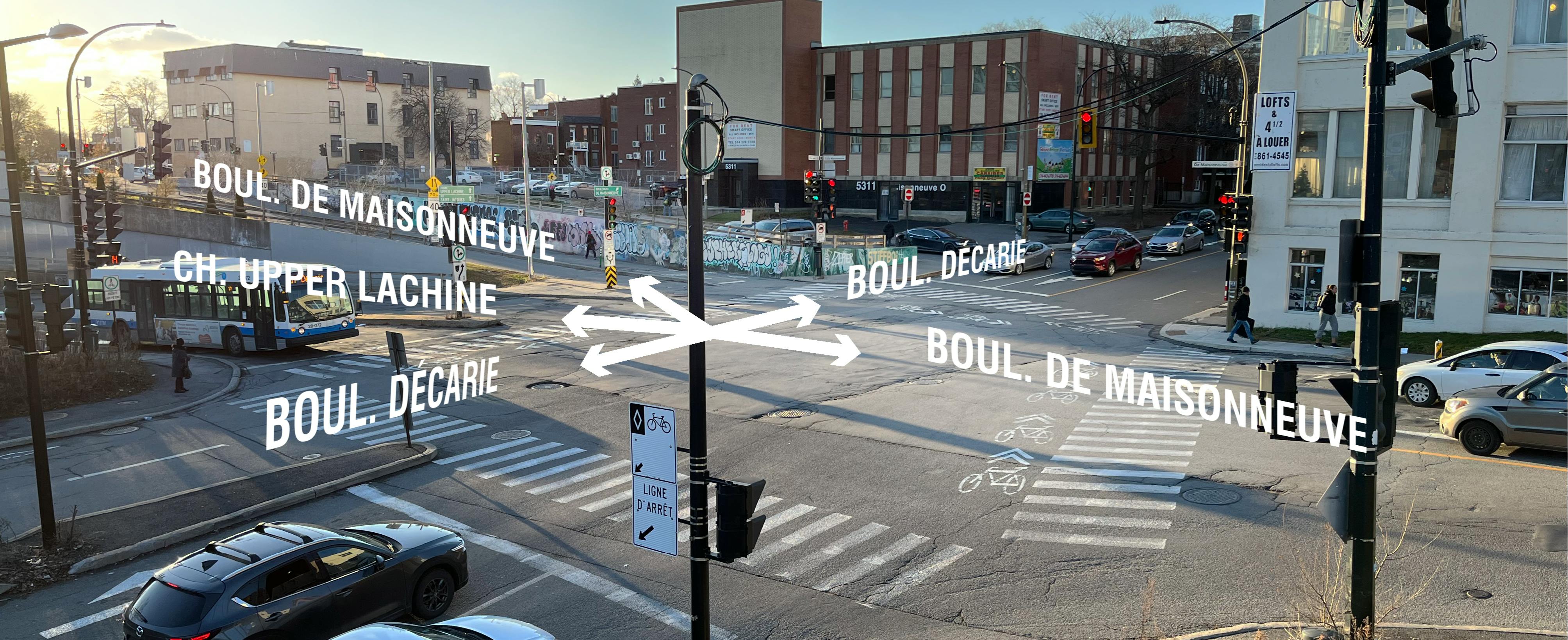
The study is prompted by the need to address mobility issues in the area, including difficulties of crossing Highway 15 and the railways, safety concerns due to road traffic, and the inadequate configuration of certain intersections.
The Ville de Montréal is committed to a citizen participation process to allow residents, users, and local stakeholders to express their views on the sector’s mobility issues and needs and to take their concerns into consideration.
Your opinion matters!
Until June 10th 2023, you can respond to our online survey. To access it, please click on the Survey tab.
You can also share with us a specific point of concern or improvement suggestion on a map. To access this, please click on the Map tab.
Collaborative map
Share your suggestions or points of attention on this map
The map represents the area we invite you to reflect on. We invite you to pinpoint one or more specific places on the map and share your areas of concern and/or suggestions for improvement.
Please add pins only within the grey perimeter.
Red pin :
Identify on the map one or more places where you have experienced a challenging, restrictive, stressful or even dangerous situation when traveling in the study area. Briefly explain the situation and the problematic elements.
For example: place a red pin on the Maisonneuve/Prud'homme intersection and add a note "I don’t feel safe riding my bike through this intersection"
Blue pin :
Identify on the map one or more locations where you envision improvements to mobility within the study area. Briefly explain your idea.
For example: place a blue pin on Maisonneuve Boulevard and add a note "The sidewalk should be widened because there are often many people around the metro station".
