Making walking and cycling safer on Stuart, Bernard and Outremont avenues
La consultation a pris fin, merci.
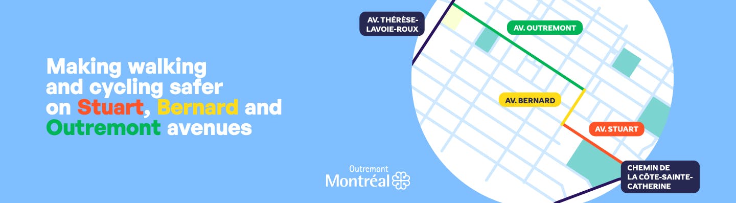
With a vision of soft and sustainable mobility, the Borough of Outremont is initiating a large-scale project to make three strategic stretches of its territory — a total distance of 1,438 metres — safer, greener and more attractive:
- Stuart Avenue, between Côte-Sainte-Catherine Road and Bernard Avenue (426 m);
- Bernard Avenue, between Stuart and Outremont avenues (216 m);
- Outremont Avenue, between Bernard and Thérèse-Lavoie-Roux avenues (796 m).
A public consultation will provide citizens with an opportunity to discuss the eventual development of safe areas for pedestrians, particularly for school, children and residents, as well as the creation of an already-defined permanent north-south bicycle path. Safety will be analyzed at the various intersections and at accesses to schools and parks.
This project aims to enable citizens of all ages in Montréal to travel more efficiently throughout the city while contributing to greening, beautification and reduction of the ecological footprint by making spaces safer for pedestrians and by implementing a year-round north-south bicycle path.
La consultation a pris fin, merci.